The Canal Saint-Martin cuts through a residential, creative part of eastern Paris, with locks, metal footbridges, cafés, and banks where locals gather. The best way to explore it is on foot between République and the Bassin de la Villette, watching the swing bridges in action and picking your stops based on the neighborhood’s rhythm.
Set aside two to three hours for the walk between Place de la République and the Rotonde de la Villette. The route is free, mostly flat, and can be shortened at the Jacques Bonsergent, Goncourt, Colonel Fabien, or Jaurès metro stations.
Why visit the Canal Saint-Martin
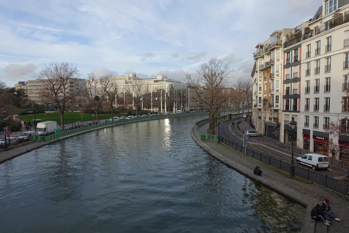
The Canal Saint-Martin shows you a Paris of everyday life. The scenery changes every few blocks: sometimes the water runs between trees and building facades, sometimes it disappears under avenues, and sometimes it opens into larger basins. You’ll see boats waiting at the locks, locals sitting on the quays, and bridges that have to swing or lift to let boats through.
Dica: Aproveite também para fazer estes passeios em Paris
Tour pelo exterior da catedral de Notre Dame + Ingresso da cripta . Duração: 2 horas
Disneyland Paris Duração: 3 horas ou mais
Passeio de barco pelo Sena. Duração: 1h
Ingresso do 3º andar da Torre Eiffel. Duração: 2 a 3 horas
Ingresso do Palácio de Versalhes. Duração: 2 a 3 horas
Veja mais passeio em Paris aqui.
This walk works especially well if you’ve already seen the main monuments. It also fits into a Paris itinerary for repeat visitors, because it connects neighborhoods and urban scenes rather than focusing on a single attraction.
Walking route along the Canal Saint-Martin
Start at Place de la République and follow boulevard Jules Ferry until the water reappears near rue du Faubourg du Temple. From there, alternate between quai de Valmy and quai de Jemmapes. The footbridges let you switch sides without commitment; there’s no “right” side for the whole route.
From the Récollets locks to Jardin Villemin
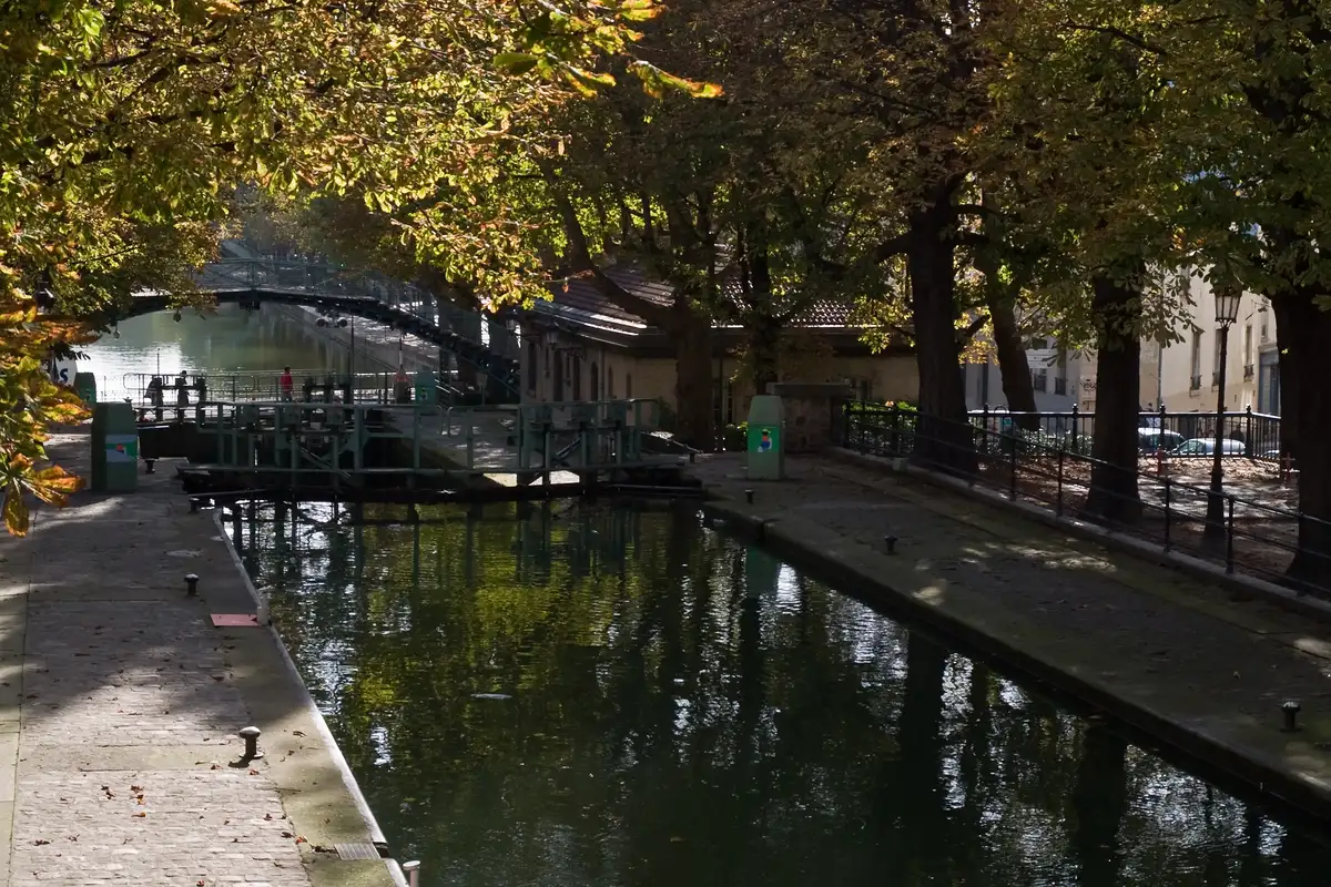
The stretch by the Récollets locks brings together curved bridges, sluice gates, and great angles for understanding how the system works. Jardin Villemin, right next door, offers benches, a lawn, and a playground. It’s the most practical break before you continue north.
From the canal to the Rotonde de la Villette
Keep heading toward Jaurès. After the curve near Colonel Fabien, the canal reaches the much wider Bassin de la Villette. The Rotonde makes a good finish line, with a nearby metro and connections to other parts of the 19th arrondissement.
Construction and swimming in the Canal Saint-Martin in 2026
The bank renovation is still underway in stages, with overall completion expected by December 2027 according to the Mairie du 10e. This can redirect pedestrians, reduce access points, or temporarily change the scenery. Don’t give up on the walk because of construction: just cross the next footbridge and pick the route back up on the other side.
In the summer of 2026, the Ville de Paris is keeping a supervised swimming area at the bassin des Récollets on specific dates and times. Outside the authorized area, swimming is prohibited and dangerous. Opening depends on water quality, weather, and operational safety; check on the day.
What the boat tour is like
The canal cruise takes longer than the walk because the boat has to go through the locks and cross the underground section under the Bastille. In exchange, you get an up-close look at how the sluice gates work and see the city from an angle the banks can’t offer.
If there’s no convenient time slot on the canal, a Seine river cruise is the simplest alternative to fit into a first-time Paris itinerary.
Why there are so many locks
The canal opened in the early 19th century to supply Paris with water and make it easier to transport goods. Over roughly 4.5 kilometers, the locks compensate for the elevation difference between the Bassin de la Villette and the Seine. Part of the route was covered over, creating the boulevards Richard-Lenoir and Jules Ferry.
The movable bridges keep boat traffic flowing without completely cutting off the streets. When a vessel approaches, it’s worth waiting a few minutes to watch the sequence: traffic stops, the bridge moves, the boat passes, and the bridge reopens.
How to get there and where to start
République, served by lines 3, 5, 8, 9, and 11, is the most flexible starting point. Jacques Bonsergent and Goncourt drop you near the central locks. Jaurès, on lines 2, 5, and 7 bis, works well if you want to start from the north and walk in the opposite direction.
What to see nearby
At the northern end, head to Parc des Buttes-Chaumont if you still have energy for hills. To the west, République leads into the Marais; to the east, Belleville adds viewpoints, street art, and restaurants from all over the world.
Is the Canal Saint-Martin worth it?
Yes, if you enjoy walking, photographing urban scenes, and watching Paris go about its day. The walk loses some appeal in heavy rain or if you’re expecting a monumental attraction. On nice days, though, the canal delivers variety at zero cost and with no reservations required.
Frequently asked questions
How long does the walk take?
The main Canal Saint-Martin walk takes two to three hours, including stops at the locks and Jardin Villemin. Without long breaks, you can do the route in about 90 minutes.
Is swimming allowed in the Canal Saint-Martin?
Swimming in the Canal Saint-Martin is only allowed in a supervised area, on the dates and times announced by the Ville de Paris. Outside that zone, entering the water is prohibited and dangerous.
What’s the best time of day?
The Canal Saint-Martin is quietest in the morning. In the late afternoon and evening, the banks fill up with more locals, especially on warm days and weekends.
Is the route accessible?
Most of the Canal Saint-Martin’s banks are flat, but construction, uneven surfaces, and footbridge access may require detours. Stick to street-level sidewalks for a route without stairs.
Conclusion
Start at République, follow the rhythm of the locks, and end at Bassin de la Villette. This route reveals a Paris lived along its banks. The Torre Eiffel helps you connect it to other neighborhoods without turning the day into a race.