The Parc des Buttes-Chaumont, in Paris’s 19th arrondissement, trades geometric gardens for hillsides, rocky outcrops, a lake, and paths that feel a world away from the city. Entry is free, but a visit in 2026 requires attention: the island, the Temple de la Sibylle, and the waterfalls are off-limits during ground stabilization work.
Set aside 1.5 to 2 hours to walk through Parc des Buttes-Chaumont, enter via the Botzaris or Buttes Chaumont metro stations, and wear sturdy shoes. Even with the 2026 closures, you’ll still find sloping lawns, viewpoints, mature trees, and great connections to Belleville and the Canal Saint-Martin.
Why visit Parc des Buttes-Chaumont
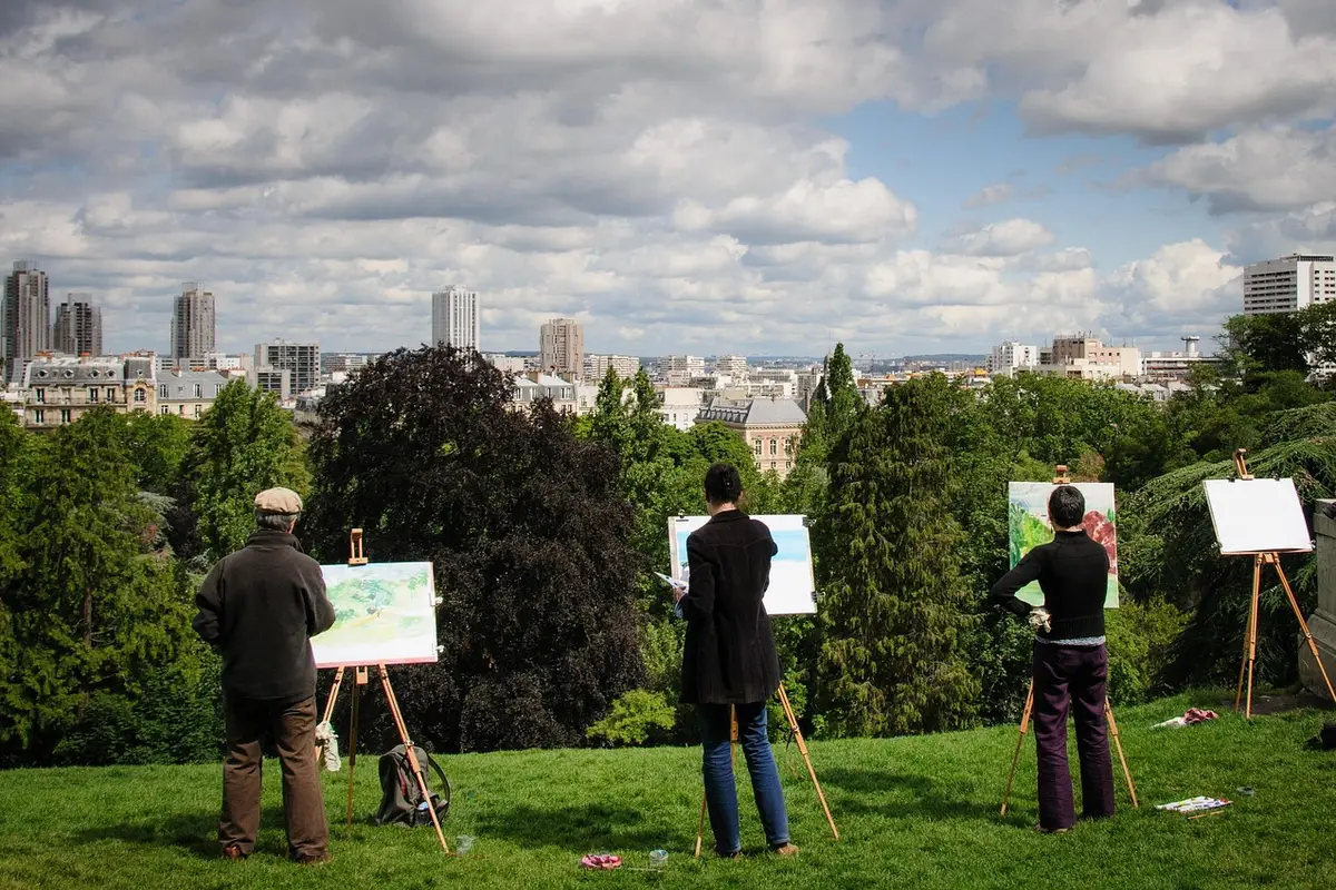
The main reason to visit the park is its terrain: 25 hectares of slopes, bridges, woodlands, and urban views that are rare in Paris. The City of Paris describes it as the steepest and largest of the city’s municipal gardens.
Dica: Aproveite também para fazer estes passeios em Paris
Tour pelo exterior da catedral de Notre Dame + Ingresso da cripta . Duração: 2 horas
Disneyland Paris Duração: 3 horas ou mais
Passeio de barco pelo Sena. Duração: 1h
Ingresso do 3º andar da Torre Eiffel. Duração: 2 a 3 horas
Ingresso do Palácio de Versalhes. Duração: 2 a 3 horas
Veja mais passeio em Paris aqui.
This scenery is artificial and was designed to surprise. Former gypsum quarries and a landfill site gave way to the park, inaugurated in 1867 during the Second Empire. Adolphe Alphand coordinated the project; Gabriel Davioud designed the architectural elements, and Jean-Pierre Barillet-Deschamps shaped the landscape.
You’ll notice the difference within the first few minutes. Instead of straight axes, the paths rise, fall, and hide the next view. It’s an interesting choice for those who already know the postcard sights or want to fit a more local morning into a Paris itinerary off the classic circuit.
What to see and do at Buttes-Chaumont
Even with closed areas, the visit is rewarding thanks to the outer viewpoints, lawns, trees, and elevated paths. The best approach is to enter without the pressure of completing an exact loop: some passages may change as work progresses.
Viewpoints and elevated paths
Look for the trails that climb along the park’s edge and open up views over the rooftops of the 19th arrondissement. The elevation change will get your heart rate up, but it lets you alternate busy stretches with quieter benches. If you’re pushing a stroller or have limited mobility, stick to the main entrances and avenues; steep shortcuts and stairs aren’t the best option.
Lake and central landscape
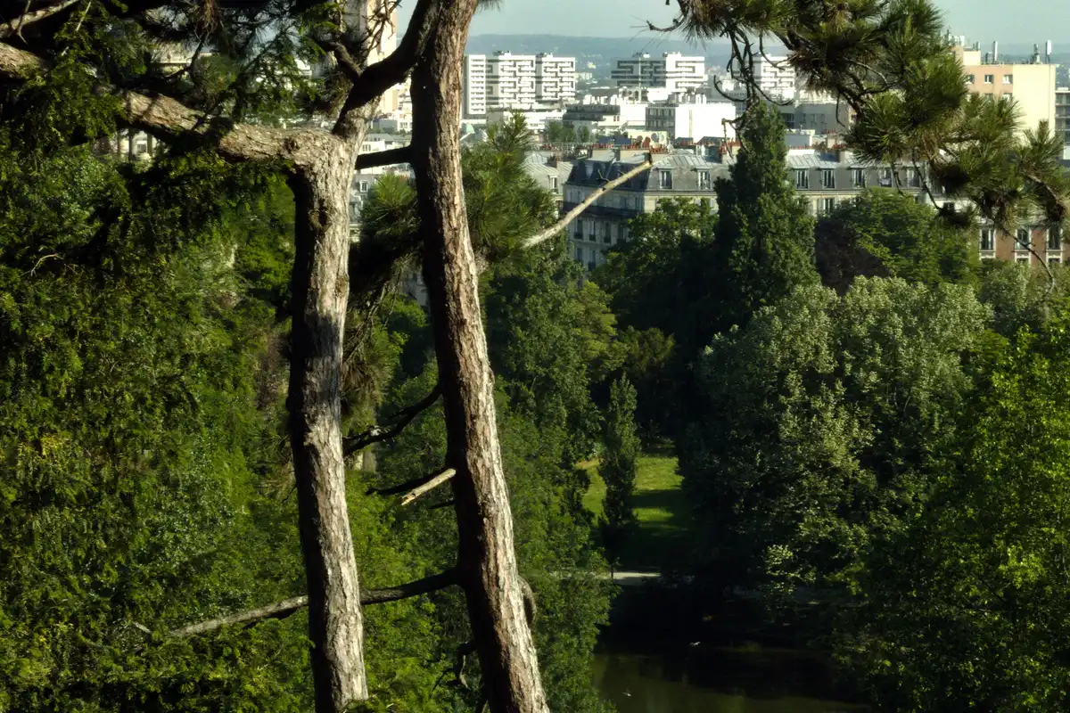
The lake sits in the lower part and anchors the most famous views. In 2026, part of the circular path is closed, so follow the local signage and don’t try to bypass barriers. You can still observe the ensemble from authorized points and understand how the project uses water, stone, and vegetation to enhance the sense of depth.
Lawns and a shady break
The sloping lawns work better for a rest than for ball games. Choose an open area, check the signs, and bring something to sit on. In summer, the trees help, but exposed spots get hot in the middle of the afternoon.
Construction work and closures in 2026
Parc des Buttes-Chaumont is undergoing a historic renovation and keeps the Île du Belvédère, the Temple de la Sibylle, and the small and large waterfalls closed. The reason given by the City of Paris is soil instability and the risk of landslides.
Don’t plan to cross the bridges, climb to the temple, or enter the grotto in July 2026. Restrictions may be expanded or reduced as work progresses. Check the official page on the day of your visit, as an itinerary from an old video might show access points that are now blocked.
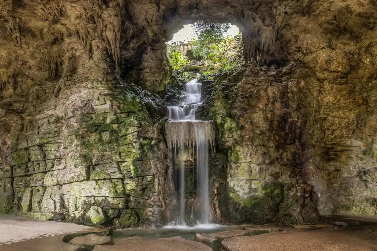
This limitation changes the experience but doesn’t eliminate the outing. Think of the park as a panoramic walk through the open sections, not as a visit to the temple. That way, you’ll avoid disappointment and can combine the remaining time with another spot in northeastern Paris.
How to get to Parc des Buttes-Chaumont
The most practical metro stations are Botzaris and Buttes Chaumont, both on line 7bis. The Botzaris entrance on rue Botzaris usually works well for reaching the upper avenues; Buttes Chaumont station drops you near the porte Fessart.
Another option is to get off at Laumière on line 5 and walk toward the main entrance at place Armand-Carrel. This option makes it easy to combine with the Canal de l’Ourcq. There are also entrances on rue Manin, rue de Crimée, and avenue Simon-Bolivar.
The park has several gates, and the elevation changes significantly between them. Save the entrance you plan to exit from on your map, especially if you have a reservation after your walk.
Best time to visit and how long to stay
Morning, between 7am and 10am, offers emptier paths and better temperatures in summer. Late afternoon brings side light to the slopes but also concentrates picnics and groups on dry days.
In July 2026, the exceptional hours are from 7am to 11:59pm, every day, as part of the summer evening opening program. Outside this period, closing times vary by season—generally earlier in fall and winter. Always check the official schedule before heading out.
Set aside 1.5 hours for a selective loop and up to 2.5 hours if you want to sit, take photos, and explore the open paths. In rain, scale back your plan: the slopes and uneven surfaces become less comfortable.
Where to eat and have a picnic
You can bring bread, cheese, fruit, and water and pick an authorized lawn. Don’t rely only on the on-site concessions: hours and operations change, especially during construction or events.
In the surrounding area, rue de Belleville and avenue Secrétan are packed with bakeries, cafés, and markets. Buying before you enter saves you from climbing back up just for water. To continue your day in a residential, multicultural neighborhood, use our guide to Belleville in Paris.
What to visit near Buttes-Chaumont
The Canal Saint-Martin is about a 25- to 35-minute walk away, depending on which exit you choose. The route descends toward the Bassin de la Villette and can fill an entire afternoon; see how to organize the outing in our Canal Saint-Martin guide.
For a combination with a strong identity, follow Belleville and its viewpoints. If you prefer contemporary architecture, exhibitions, and music, the Parc de la Villette extends your day without forcing you to cross Paris.
If you want an organized introduction to the city’s artistic north, you can book a free tour of Montmartre and Sacré-Cœur for another part of your itinerary.
Practical Tips for Visiting Without Tripping Up Your Itinerary
Wear sturdy-soled sneakers, bring water, and check the forecast. Restrooms and water fountains exist, but they can be far apart depending on which section is open. Bikes don’t mix well with the steepest shortcuts; walking lets you adapt more easily to detours.
- Free entry with no reservation required.
- Build in extra time for path changes during the construction work.
- Don’t cross barriers or safety tape.
- On hot days, go in the morning or late afternoon.
- For photos, the high rim offers more options than the closed-off lower area.
If this is your first time in the city, a free walking tour of central Paris helps put the monuments in context before you explore farther-flung neighborhoods.
Frequently Asked Questions
Is Parc des Buttes-Chaumont free?
Parc des Buttes-Chaumont has free entry and doesn’t require a reservation. You just need to respect the seasonal hours, temporarily closed areas, and the safety guidelines posted at the entrances.
Is the Temple de la Sibylle open in 2026?
The Temple de la Sibylle, the central island, and its bridges are closed in July 2026 due to soil instability and landslide risk. Check with the City of Paris before your visit to confirm any changes.
Which metro should I take for Buttes-Chaumont?
Botzaris and Buttes Chaumont stations on line 7bis are the closest. Laumière on line 5 also works well if you’re entering from the place Armand-Carrel side.
How much time do I need to visit the park?
A visit to Parc des Buttes-Chaumont takes about 1.5 to 2 hours. Allow more time if you want to picnic or combine the park with Belleville and the Canal Saint-Martin.
To compare another landscape project off the classic circuit, check out Parc André Citroën, with its geometric gardens and tethered balloon.
Conclusion
Buttes-Chaumont is still worth the hike across its slopes, trees, and open views, as long as you adjust your expectations for the 2026 construction. Check the access points on the day, pick a nearby combo, and leave the rest of your Paris itinerary to Torre Eiffel.